Chambers Flat Road Upgrade
Project overview
With Logan’s population set to continue growing, we are investing in our roads to ensure they are fit for purpose, now and well into the future.
As a vital east-west link, this upgrade to Chambers Flat Road will improve safety, flood resilience and travel conditions for everyday users.
We are upgrading 3.8 kilometres of road from Mount Lindesay Highway, Munruben to just north of Kings Way, Chambers Flat.
Traffic is expected to increase significantly over the next 20 years due to residential and business growth. The upgrade will allow Chambers Flat Road to safely accommodate future traffic demands from local and adjoining development areas.
Chambers Flat Road currently carries approximately 19,000 vehicles a day.
This figure is expected to rise by 47 per cent to approximately 28,000 vehicles a day.
Project outcomes
Improved road safety and flood resilience for all users
Division
Divisions 8, 9 and 11
Address
Chambers Flat Road from Mount Lindesay Highway, Munruben to just north of Kings Way, Chambers Flat
| Latest update |
The Chambers Flat one-way only access remains open to traffic proceeding west from near Grevillea Road intersection towards Mount Lindesay Highway.
With the potential for heavy rain continuing, we are monitoring conditions and will provide further updates, as necessary.
The Norris Creek bridge westbound one-way sidetrack may be closed if it floods. The flooding is caused by heavy rain in the Norris Creek catchment combined with tidal backup of floodwaters in the Logan River.
Zone 3 – Greenvale Road intersection upgrade
To upgrade Greenvale Road intersection, a sidetrack will connect Greenvale Road to the new western lane end of Norris Creek Bridge.
This will be controlled by temporary traffic signals for the safety of road users and staff.
Road users traveling west from Chambers Flat will access Greenvale Road via a left turn off the bridge.
Traffic exiting Greenvale Road will turn left only onto the western lane towards Mt Lindesay Highway.
The one-way diversion to Mt Lindesay Highway from Grevillea Road and Greenvale Road to Munruben Ambulance Station will remain in force to allow construction on the eastbound lane until the project is completed in late 2024.
Greenvale Road residents will receive further information about the upcoming traffic changes and impacts in their letterboxes.
For your safety, please follow directional signs and posted speed limits.
Please note, it is a serious offence to move road safety barriers, bollards, or other road safety devices and to ignore road closure signs. These will be monitored.
If you want to find out more about the works, see construction updates for March 2024 (PDF 1.16 MB) |
|---|---|
| Documents |
Project work zone area (PDF 11 MB) Initial construction notificationProject work plans
Intersection designs
Project updates
|
Project features
The project will:
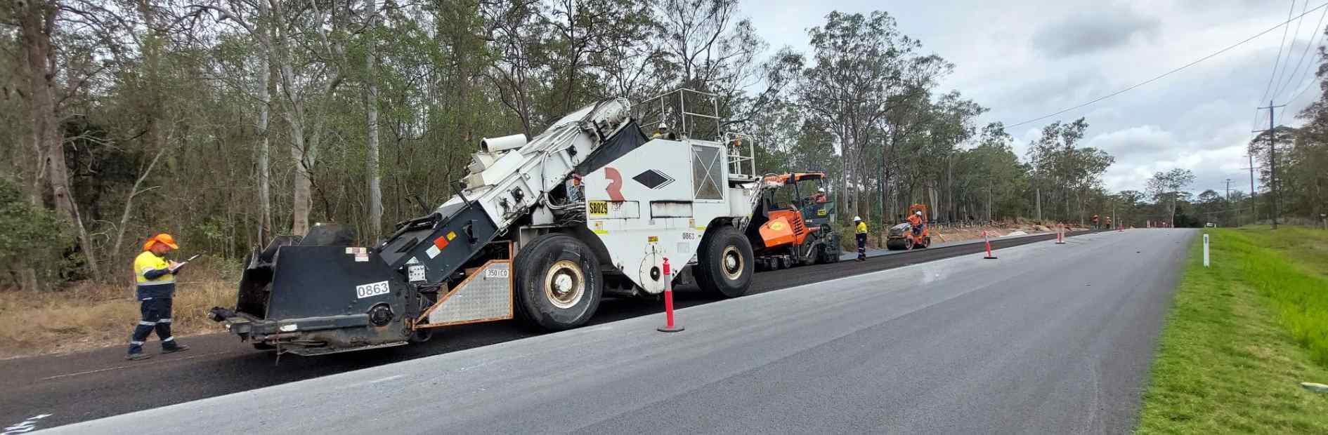
- widen the road with 3.5m-wide traffic lanes and 3m-wide sealed shoulders (asphalted to provide a safer, smoother road with reduced tyre noise impacts for residents)
- reinstate 80km/h speed limit once the road is commissioned
- build a new bridge over Norris Creek (up to 8m higher than the existing culvert)
- improve the intersections at Kings Way and Greenvale Road to include dedicated turning lanes from Chambers Flat Road
- upgrade Grevillea Road and Norris Creek Road intersections
- improve sight lines at bends and crests
- install new stormwater drainage
- install a variety of wildlife devices including fauna fencing, escape poles, culvert crossings and nesting boxes.
Norris Creek Bridge
Modelling was undertaken during design of the new Norris Creek bridge for both local storm and regional flood events, to ensure future flooding impacts are mitigated.
According to the modelling, during a 1-in-100-year Norris Creek storm event, water levels are expected to peak below the bridge. During a 1-in-20-year Logan River flood event, backwater would push up Norris Creek from Logan River, with water levels expected to peak under the bridge road level. A more severe flood would overtop the bridge, according to the studies.
With the existing culverts removed and the bridge and associated earthworks constructed, modelling indicates no adverse impacts during events up to and including the 1-in-100-year storm and regional flood.
View the Norris Creek Bridge construction progress on Facebook
Project benefits
The upgraded road will help to:
- improve safety as traffic increases
- improve sight lines for crests and curves
- unlock local bottlenecks for more reliable travel times
- improve flood resilience
- build a well-managed road network to improve access and economic opportunity.
Project impacts
Our contractor, SEE Civil Pty Ltd, is making every effort to minimise disruption. Given the nature of works, some temporary construction impacts can be expected:
- increased levels of noise, dust, and vibration, particularly at Norris Creek bridge site
- delays while bridge beams and decking units are transported to site and lifted into place
- temporary lane switches
- property fencing works
- continued driveway and road drainage works
- temporary side track at Greendale Road intersection upgrade works
- changed traffic conditions, including diversions, traffic congestion and travel delays.
Road users are advised to plan their journey and allow extra travel time. We thank you for your cooperation and patience as we work to provide a safer, more resilient and reliable road network.
We will continue to work with SEE Civil Pty Ltd to reduce these impacts as much as practical by:
- suppressing dust on site during the works (via water truck or dust suppression agent)
- directing lighting away from properties as much as possible
- reducing noise as much as possible (although some activities will make it unavoidable at times)
- undertaking noise monitoring.
Through traffic restrictions
The eastbound lane was closed at the start of the project and through traffic is diverted until mid-2024. Please see the Detour map (PDF 195 KB).
The eastbound and westbound lanes of Chambers Flat Road will be opened progressively from Riverina Court and Kings Way as the road is commissioned.
Local traffic
The westbound lane has remained open with reduced speed limits in place to provide residents access to the Mount Lindesay Highway and Crowson Lane.
Heavy Vehicles
Due to the size and scope of the works, our contractor, SEE Civil Pty Ltd, established their site compound on Council-owned property at 296-308 Teviot Road, North Maclean for the duration of the project.
You may see materials relating to drainage and bridge supports in addition to prefabricated structures and temporary stockpiling of earth at this site.
We have asked our contractor to avoid hauling materials with trucks along Greenbank Road.
Please view the preferred routes for heavy vehicles (PDF 295 KB).
Increased noise and dust will continue to occur as these vehicles travel along these approved routes until they are no longer required for the project.
Register for updates
You can receive project construction notifications direct to your email inbox by contacting SEE Civil Community Relations Advisor:
Phone: 0439 235 778
Email: info@SEECivil.com.au
Register for email updates direct to your email inbox.
Frequently asked questions
Please view the frequently asked questions.
Related projects
- Crowson Lane Extension, North Maclean (Mount Lindesay Highway to Teviot Road)
- New Beith Road and Goodna Road Upgrade, Greenbank
- Teviot Road Upgrade
Contact us
If you would like more information about the project, please:
- call our Project Communications Team on 07 3412 3412
- email us at RoadComms@logan.qld.gov.au or
- write to us, please address your letter to:
- Road Infrastructure Delivery - Chambers Flat Road Upgrade
Logan City Council,
PO Box 3226,
Logan City DC, QLD, 4114.
- Road Infrastructure Delivery - Chambers Flat Road Upgrade
Our project team will respond to community questions as soon as possible.