Council endorses evidence-based improvements to flood mapping
Published on 04 June 2026
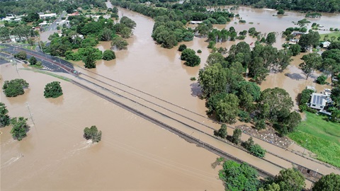
Logan City Council has endorsed a set of targeted improvements to its flood mapping informed by community feedback and an independent external review.
The changes were considered at a Special Council meeting, following detailed consideration of the Logan and Albert Rivers Flood Study.
Mayor Jon Raven said the improvements responded to community feedback and made the city’s flood mapping easier for residents to understand and use.
“We heard loud and clear that the community wanted change and Councillors and I have made important decisions today to bring about improvements to the flood mapping for our city,” Mayor Raven said.
“This work is about getting the balance right, improving Logan’s flood mapping so residents have clear and practical information while keeping strong protections in place to safeguard life and property.
“That’s what our community expects and that’s what we’re delivering.
“These improvements will make a real difference for more than 25,000 properties across our city.”
Changes supported at the Special Council meeting include:
- removing flood events less likely than a 1% annual chance (1 in 100) from the flood maps – including the most extreme event, the Probable Maximum Flood (PMF) – as recommended in the independent review
- improving flood risk awareness maps
- changing how dry creeks and gullies are mapped
- retaining a common-sense approach to house extensions in the floodplain.
These changes are grounded in independent technical advice, align with State and national modelling guidance and introduce targeted updates to planning controls to provide a more practical and balanced approach for property owners.
Council also endorsed the development of a new Temporary Local Planning Instrument (TLPI), a State Government-approved method for introducing planning changes in the public interest sooner.
“A TLPI is the fastest and most effective way to bring about the urgent changes that the people of Logan have been calling for,” Mayor Raven said.
“While the TLPI process doesn’t require formal consultation, Council received 4000 submissions on the draft Logan Plan, with the vast majority about flood mapping.
“The work is not over. We’ll continue to work closely with the State Government to bring about change for Logan and communities across Queensland.”
The Special Council meeting held today was open to the public and is available to watch on Council’s YouTube channel.
More information on the improvements to flood mapping and policy endorsed by Council is available on a dedicated webpage at: Flood maps. It also provides updates, timelines, FAQs and background information.
Snapshot of what was endorsed at the Special Council meeting:
Low Flood Risk Area: Remove flood events less likely than the 1% annual chance event (1 in 100), including the 1 in 2000 event and the Probable Maximum Flood (PMF), from the Flood Overlay Map. Introduce a new development code in the planning scheme to manage essential community infrastructure and vulnerable uses (such as hospitals and childcare centres).
High Flow Area terminology: Replace existing flood risk terminology with a consistent Flood Planning Area framework (Flood Planning Areas 1, 2 and 3), to provide clearer, more consistent descriptions of flood risk in response to community feedback.
High Flow Area Policy: Allow open structures, such as carports, to be considered in Flood Planning Area 1, subject to requirements for safe design to ensure flood flow is not obstructed and floodplain function is maintained.
Small Scale Extensions: Retain the current policy that allows extensions under 25sqm (outside Flood Planning Area 1) without assessment under the flood provisions of the planning scheme. This supports modest extensions while maintaining appropriate flood safety and resilience. Larger extensions can still be considered but will require a development application for assessment.
Shelter-in-place Policy: Refine the policy to provide clearer guidance on how evacuation and shelter‑in‑place provisions apply to houses, while retaining the current approach that isolation (shelter in place) is suitable for less than 36 hours.
Dry Creeks and Gullies: Introduce a new Flood Planning Area (Flood Planning Area 4) to better reflect the nature of flooding in dry creeks and gullies, with a more proportionate approach where flooding may be frequent but shallow. Council also endorsed to engage further expertise to undertake a review of the assumptions and methodology used to develop the current creek mapping.
Flood Portal: Improve flood risk awareness mapping in the Flood Portal to remove the Probable Maximum Flood (PMF) and show a 1 in 100 annual chance event on the key maps tab with larger floods up to a 1 in 2000 annual chance event available on the other maps tab. This aligns with the recommendations of the independent review that including the PMF is more likely to cause alarm and is more relevant to emergency planning.